Welcome to The 0K Blog
June 1, 2007
Puget Sound to the Columbia
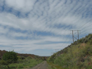 Over the Memorial Day weekend, I went on a little bike ride from North Bend to the Columbia River, following the old grade of the former Chicago, Milwaukee, St. Paul, and Pacific (CMStP&P) Railroad, aka, the "Milwaukee Road".
The Milwaukee Road was the third of the transcontinental railroads to reach the Puget Sound area. It was a well-designed railroad, and the line was even electrified, but being the third arrival to the region in 1909, it missed out on the lucrative terminal and industry connections that the first two railroads, Great Northern and Northern Pacific, enjoyed. After the federal government came through and built the interstate network, the Milwaukee Road couldn't compete with the trucking industry, which was effectively subsidized by the government (see a term paper I wrote a few years ago for a more in-depth discussion of truck-rail freight economics). The Milwaukee Road went bankrupt in the late 1970's and this right-of-way was abandoned in the early 1980's.
Today, much of the right-of way has been converted into a trail, called the John Wayne Trail or Iron Horse State Park. Last weekend, I took advantage of the misfortune of the Milwaukee Road and followed the grade on my bike all the way to the Columbia River.
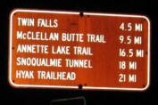 I started out on Thursday; went to work with my bike all packed up and ready for several days of camping. After work, I loaded my bike onto a Route 214 bus, which provides direct service to North Bend during rush-hour. In North Bend, I loaded up on spaghetti and headed up the Snoqualmie Valley Trail as the sun began to set. The Snoqualmie Valley Trail is built along a spur line of the Milwaukee Road, and it intercepts the old mainline near Rattlesnake Lake. It was getting dark as I passed Rattlesnake Lake, and I proceeded up the grade with my headlamp.
About 5 miles west of the Snoqualmie Tunnel, I came across a newish-looking campsite near Carter Creek. It was right next to the creek, below the railroad grade that blocked the roar of I-90, and was furnished with picnic tables and gravel tent pads; it looked very inviting so I decided to call it a night and crash here.
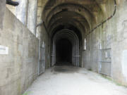 The next morning, Friday, I headed up the remaining distance to the Snoqualmie Tunnel, rode through its 2.3 miles of darkness (a headlamp or headlight is pretty much a requirement for this stretch), and emerged at Hyak. After Hyak, the trail skirts the south side of lake Keechelus and then begins a long and gradual descent.
The town of South Cle Elum was the old crew change point on the Milwaukee Road. Today the old South Cle Elum rail depot has been converted into a cafe and museum; this was a welcome amenity because it was just past lunchtime and I was getting hungry. I fueled up on a grilled cheese sandwich and chocolate milkshake, and explored the museum and interpretive trail before continuing east towards Ellensburg.
While I-90 climbs to 'Elk Heights' between Cle Elum and Ellensburg, the old railroad grade follows a narrow canyon adjacent to the Yakima River, with the BNSF Stampede line still operating on the opposite side of the Canyon. There are several tunnels along this stretch. I reached Ellensburg in the evening, found no reason to stop, and continued towards Kittitas. In Kittitas, I stocked up with as much water as I could carry, because I presumed that it would be the last potable water source until the Columbia River. When I left Kittitas, it was getting dark, so I scoped out a campsite just a few miles east of town.
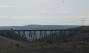 The next morning, I continued heading east. The first obstacle that I encountered was an old trestle that was impassible because the decking had been removed (I-90 passes directly underneath this trestle). The official detour is to take Prater Rd and then Boylston Rd, but I just followed the grade all the way to the trestle, and then followed an access road for a nearby irrigation canal to Stevens Rd, which passes underneath I-90.
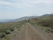 After the trestle, the grade enters the Yakima Firing Range, under jurisdiction of the US Army. This section of the trail is remote and desolate. Also, the trail surface isn't the best to ride on; a layer of loose sand on top of a rough base that has been torn up by horses. If the horses would only stay to one side of the trail, then it would leave a nice smooth surface for bikes to use on the other side. Alas, this is not the case and it was slow going even with my fat tires. The grade climbs up to the Boylston Tunnel and then plunges 2000' down to the Columbia River. The descent was somewhat difficult due to the aforementioned surface, but the scenery was spectacular and grade goes through an impressive set of cuts and fills through the rolling hills.
Just a few miles shy of the Columbia River, I spotted the most wonderful sign of the trip, it read "POTABLE WATER" with an arrow. I followed it and found myself at an oasis of sorts, courtesy of the US Army. I re-hydrated, munched on some food, took a nice long nap, and then continued down the grade feeling quite refreshed. I didn't realize how close I was to the Columbia; within minutes the river was in sight.
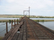 At the Columbia, the old railroad bridge is unfortunately fenced off and closed to all traffic. The decking isn't in too bad of shape, and it would have been physically possible to unpack my bike and lift it over the barbed wire fence, but I didn't feel a pressing need to get to the other side. By chance, I met up with some nice folks who let me put my bike on their rack, and they gave me a ride over the I-90 bridge to some good camping spots. This place was a zoo, the Sasquatch Festival was going on at the Gorge Amphitheater nearby, and most campsites were packed. But I managed to find a nice camping spot near the river, and met a local rattlesnake there.
The next Morning, Sunday, I intended to ride back west towards Ellensburg. I decided to forgo the trail because of its tough surface, and instead climb the 2000' on the nice paved shoulder of I-90. After I packed up and began riding, I noticed that my front wheel hub was seized up and wouldn't turn very well. I could ride, but I was losing a lot of effort to friction in that hub. I headed to I-90 and crossed back over the Columbia. Riding over that bridge is VERY SKETCHY, there is no shoulder or sidewalk, and you pretty much have to ride in the traffic lane. (Thanks WSDOT!) I slowly made my way to Vantage and stopped at a gas station. I bought some 3-in-1 oil, hoping to be able to do something about my seized hub. Well, what I ended up doing was spilling the ball bearings all over the gas station driveway, recovering all but 3 of them.
A few minutes after this fiasco, some people I knew recognized me at the gas station. They were friends of my friend Evan, and they were there for Sasquatch. I told them of my plight, and we managed to tie my bike to the roof of their car and squeeze myself in for a ride back to Seattle. Within a few hours, I was back home in Seattle.
[See more pictures].
May 14, 2007
Faster buses on Lake City Way
Over the past few weeks I have been working overtime getting a Transit Signal Priority (TSP) system up and running on Lake City Way, located in north Seattle. TSP is basically a system that detects buses approaching a traffic signal, and adjusts the signal timing so that the bus gets through faster. My job now is to make sure that the software is running properly and that all of the various settings are all properly configured; these include parameters such as duration time, frequency, cycle-minus-split time, detection mode, and the Eligible Vehicle Table. This work takes a lot of time in the field, watching traffic during the AM and PM peaks and tweaking the TSP timings so that the system works optimally. Once I'm finished, TSP will be running on most of the signals on Lake City Way between NE 80th Street and NE 145th Street, giving priority to routes 522 and 372.
Tomorrow I have an appointment to meet a SDOT traffic signal technician on Lake City Way at 7:00 AM, to observe and adjust the AM peak settings. That's way too early for me, why can't you people commute to work later so that I don't have to wake up so damn early?
April 28, 2007
New Website Features
I have been learning to use a little bit of PHP, which is a server-side scripting language for making dynamic web pages. Tonight, I used this new skill to make a few new things on my website. One of these is a readout on my homepage that tells you when I have last updated this blog. This is done with a short PHP script that retunes the date & time that this file was last modified. Now when you visit my homepage, you can tell whether I have posted anything new.
Also, I have retuned my text-messaging page into operation, but now it is password protected. I was having a problem with rouge form-filling robots that were using the page to send spam to my mobile phone; hopefully this measure will put an end to that. The username and password are easy for non-robots; just enter the word human in both fields.
April 16, 2007
Paying for Traffic
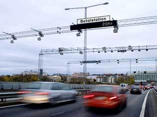 Last week, I watched a web conference on congestion pricing presented by the USDOT National Strategy to Reduce Congestion, and now I'm sold on the idea. Congestion pricing is the concept of charging a toll for a roadway using a variable price that is increased during periods of high demand. As an example, consider the SR-520 bridge across lake Washington (which used to have a toll when it first opened, by the way), it is heavily congested in both directions during both AM and PM peaks. A toll of, for example, $10 could be charged during the peak periods, $3 during lower-demand periods, and no toll in the middle of the night. These prices would be adjusted periodically to maintain optimal traffic flow on the bridge at maximum capacity (which occurs at a speed of about 45mph). Tolling could be done electronically at freeway speeds, using inexpensive transponders that drivers would mount on their vehicles. If done properly, the result would be a reliable congestion-free trip every time, only more expensive during the peak periods. This would provide a real financial incentive for people to take transit, carpool, or adjust their schedules to not drive during rush hour.
The 520 bridge is a fairly simple example, but imagine if a similar system were used on the freeways throughout the region. Maybe we wouldn't need a replacement of the Alaskan Way Viaduct, or an expansion of I-405, just increase the cost to travel during the peak periods. If the demand is really there, then funding for roadway expansion is readily available from those people who would directly benefit from the additional capacity. Express buses would operate fast and reliably, and would be a more competitive mode of travel. Some of the revenue could go to funding additional transit service or could even be returned to the public as a rebate. There has been a lot of press coverage lately about road tolls and how a simple toll will not cover the cost of replacing the SR-520 bridge unless the I-90 bridge is tolled as well. Why not just expand the toll to the entire regional highway system and make it all operate congestion-free all the time? Getting your electronic toll transponder would be like renewing your license-plate tabs, and facilities could be provided at entry points into the tolling zone where visitors could get a temporary transponder.
I used to have some reservations about this kind of a tolling system. One of them was that it would disproportionately impact low-income people and families; opponents of these kinds of toll facilities have sometimes used the term "Lexus Lanes" to describe these variable tool facilities. However, in a few experimental facilities that have been constructed, such as one in California and where drivers have an option to bypass congestion for a toll, survey data has shown equal amounts of usage by people between medium-low to high income levels. For the lowest income people, who cannot afford a car, they will surely benefit from the demand for additional and better transit service. I also think that this would be a more progressive form of tax than the gas tax, because more of the people who drive during peak hours are those who have high-paying jobs and tight schedules.
Another concern with electronic tolling is that government could be able to track your movements, and there is the potential for abuse of the data that could be collected from an electronic tolling scheme, either by government agencies or by the companies that might be contracted to operate the toll system. The web conference presenter used the example of Singapore, which has implemented a toll in some of its congested urban areas; their system uses an anonymous "cash card" that works like a transit fare card. The user just adds value to the cash card, and inserts it into an in-dash transponder when his/her vehicle passes into the tolling district, and no personal data is exchanged in the process. In the Puget Sound area, this cash card system could be linked to the regional transit smart card that is being developed, so that one card could handle your transit fares as well as your road tolls.
Some economic theory:
Traffic congestion is the result of demand exceeding the available supply. In an ideal market situation, supply and demand are equalized through price. For example, if there is a shortage of pepper, then the price of pepper goes up and people are forced to conserve; those who love pepper and couldn't live without it will still use pepper and pay the higher price, but those who could take-or-leave pepper or who think that curry is an acceptable substitute will stop using pepper, ensuring that the pepper lovers have adequate supply. In the case of our freeways, the person who lives 1/4 mile from a bus stop but chooses to drive their fancy car because it has a heated seat, shares the same cost as the truck driver carrying the truckload of pepper that would bring an end to the pepper famine. As you can see, this is not a very efficient use of resources. The way that the road capacity resource is managed on the freeway is to make people wait in line, just like the bread lines in the former Communist Soviet Union. This doesn't see like the American Way ™ to do things.
In conclusion, if you don't think that congestion pricing is a good idea, then you're a Red Communist.
April 3, 2007
Integration
Yes, I have been neglecting my blog for a while. I have been busy cleaning and organizing my house because Amie is moving in!
This house is kind of small, and it is a challenge to integrate all of our stuff together with the limited square footage and
the odd layout of my 1900-vintage house. The loft project has been put on hold pending the installation of a new water heater
and removal of the dilapidated chimney, but once that is done, then we'll have a bit more space to work with.
Also, I have uploaded a new mix to my soundz page, which I recorded about a month ago. I think it
turned out really well and it includes some of my very favorite tracks of late. Check it out sometime when you find yourself with idle ears.
March 11, 2007
Viaduct Vote
By this Tuesday, City of Seattle residents have to mail in their ballots for the special election to select an alternative to replace the Alaskan Way Viaduct. There are two questions:
- Do you prefer the elevated structure alternative?
- Do you prefer the hybrid tunnel alternative?
Setting aside comments on the strange formulation of these questions and the wisdom of calling a special election to ask them, I am suggesting a NO vote on both questions for reasons that I outlined earlier. Basically, if you agree that we should be reducing automobile use and building alternative transportation systems, then what better way to attain that goal than to not build a new freeway?
February 27, 2007
Mechanics and Spelunking
Last weekend I went to explore the site of an old mine near Index. It was kind of a continuation of a snowshoe trip from the prior weekend. That weekend I went out snowshoeing with my dad at Surprise Creek near Steven's Pass. On the way home on Highway 2, just as we passed through the tunnel near Skykomish, my truck suddenly ceased to be functional. It had to be towed to Sultan where it was left with the hands of experts while Amie and I crammed into my dad's Explorer. It turns out that the problem was just a blown fuse on the circuit that runs the fuel injection; I guess that one is important.
So last Friday, using my extensive knowledge of the regional transit system, I made my way up to Sultan to retrieve my truck. Since I was going to be almost into the mountains anyway, what better thing to do than to explore an old mine? I picked out a site near the town of Index, the Sunset Mine, because it was is low in elevation, about 1400', below snow level I thought. At one time, the Sunset Mine was one of the largest producing mines in the cascades.
The mine road up Trout Creek turns off of the Index-Galena Road just before the big washout that's currently blocking that road. The mine road is in a pretty sorry condition, with big boulders and ruts making it almost impassible even in my truck. I parked at a wide spot and walked the last 3/4 mile because walking was just as fast as driving the road.
The first noticeable feature of the mine site is the foundation of the old ore concentrator, just off of the road. The underground workings at this site are extensive, according to my reference, but not much of it can be explored due to cave-ins. One of the tunnels is partly open, but flooded with a several feet of water near the adit; I had no hip-waiters with me, so I would not be going in. The most interesting part of the mine is up above the adits, there are two gaping holes at the point where one of the veins rises to the surface. This collapse happened when the mine was still in operation, and they continued mining even after the collapse. I explored a short distance into these caverns, because it looked very sketchy to go any further. I collected a few ore samples to take home.
As I walked back to the concentrator site and then back down the road, it started to snow heavily. I returned to my truck, made my way back down the miserable road, then back to Seattle in time for dinner.
Some Pictures:
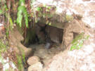 Collapsed mine adit.
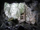 Looking out to the surface from inside the hole.
 Waterfalls draining into the hole.
 Old bulding nestled inside the collapsed area.
February 12, 2007
Sickly Spring Weekend
Yuck, I've been sick with something flu-like through all of last weekend. I was stuck at home trying to get some rest and heal, so I didn't go out and do much. Amie was sick too, and so our wild adventure of the weekend was to go to the conservatory at Volunteer Park to check out their funny plants. I also updated my homepage a bit, and I even motivated myself to contribute to a few Wikipedia articles, about Road Diets, Bus Stops, and Bus Turnouts. I'm mostly better now, except I still have a cough and I seem to be getting an ear infection :-(
It's starting to look like spring around here; the grass looks like it could almost use a mow soon.
To continue into the past of the 0K Blog, click here: [2006.3].
© 2007 Owen Kehoe
Route feedback to:

< -- BACK TO OWEN'S PORTAL
 I started out on Thursday; went to work with my bike all packed up and ready for several days of camping. After work, I loaded my bike onto a Route 214 bus, which provides direct service to North Bend during rush-hour. In North Bend, I loaded up on spaghetti and headed up the Snoqualmie Valley Trail as the sun began to set. The Snoqualmie Valley Trail is built along a spur line of the Milwaukee Road, and it intercepts the old mainline near Rattlesnake Lake. It was getting dark as I passed Rattlesnake Lake, and I proceeded up the grade with my headlamp.
 Over the Memorial Day weekend, I went on a little bike ride from North Bend to the Columbia River, following the old grade of the former Chicago, Milwaukee, St. Paul, and Pacific (CMStP&P) Railroad, aka, the "Milwaukee Road".


 Last week, I watched a web conference on congestion pricing presented by the USDOT


