About a month after summiting Mt St. Helens, I climbed its neighbor, Mt. Adams.
I took the Amtrak Cascades to Portland on Friday morning, where I hooked up with my friend JP. The train arrived on time at 11:00. JP picked me up at the station, we picked up a few supplies in town, and then headed to Trout Lake to obtain our permits. There was still snow on road 500, so we had to hike a couple of miles to Cold Springs Camp, which is the usual starting point for the South Climb route. Although Mount Adams is large, the 2nd highest in Washington State, the South Climb route is a non-technical scramble; the mountain is just begging to be climbed.
With a late-afternoon start, we started our upward march through the snow with overnight packs. Our goal was to camp at Lunch Counter, elevation 9,400'. We made it to the counter around 8:30pm; that might seem late, but it was just a few days after the solstice and there was ample daylight especially at this elevation. The sunset was incredible, and a nearly full moon emerged out of Adams' shadow just as the sun set. The full moon was welcome since it was getting dark as we cooked dinner. I had forgotten my bivy sack but i was able to fashion a lean-to out of a tarp, which worked well except my feet got cold until I got a plastic bag to wrap around the bottom of my sleeping bag. I think this was the highest elevation that I have ever camped at.
Around 4:00am, JP woke me up, I peeked outside our tarp. There was a lunar eclipse this morning, and it was quite visible just above the horizon. I admired this for a minute and then crawled back into my sleeping bag.
On Saturday, we had slept in and had a lazy morning. By 11:00 we finally departed camp with day packs. There were lots of climbers out today, and they looked like ants on the mountain ahead. There were a surprising number of people on skis, mostly fancy Randonnee with skins. We reached the 12,276' summit around 2:00. It was windy but the view was incredible on this perfectly clear day. We ate lunch and hung out at the top for a while, then scampered back down. There were some awesome butt-glissade chutes from previous climbers that we utilized; they were like riding down a luge track!
Within an hour we were back at the lunch counter camp. We packed up and continued our descent. After a full day of sun, the snow was pretty soft and slushy; snowshoes would have been nice in some spots, although I am undecided about whether they would have been worth the bother. We were back at JP's Volvo by about 7:15. On the drive back, we could look back and see the mountain that we were on top of mere hours earlier.
On Saturday night I crashed out at JP's place in Portland. Then on Sunday I took the Cascades train northbound back to Seattle, and was back in time for Titanium Sporkestra practice, although about an hour late.
Speaking of Titanium Sporkestra, this week I leave on tour with said band to northern California. We are playing at the Marin County Fair, among other gigs we have lined up. We'll be gone for about a week.
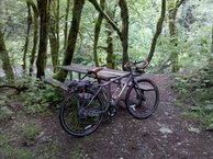
Yesterday I went on a long-ish bike ride through some new territory. Starting from home, I headed east over I-90 to Issaquah. In Issaquah I turned south, following Issaquah-Hobart Rd and then Ceder Grove Rd. At the end of Cedar Grove Rd, I intercepted the Ceder River trail, and followed it upstream to the end at Landsburg Park, near the intake for the Cedar River watershed, the souce of 70% of Seattle's municipal water supply. After a snack at the park, I headed back down the Cedar River trail all the way to Renton. From Renton, I followed the usual route home via Rainier Ave S and Seward Park Blvd. Total distance: 57 miles.
[approximate map of the route], courtesy of Google Maps Bike Directions!
Near the 30th anniversary of the infamous Mt. St. Helens eruption, I climbed it. My friend Evan organized an outing for a group of 5 on May 23, five days after the 30th Anniversary of the big eruption. This would be my second time climbing Mt St Helens; the last time was almost 10 years ago when I was living in the dorms at UW.
We headed out Saturday afternoon and camped at the Marble Mountain Sno Park that night, elevation 2600'. There is a very elaborate day-use shelter at Marble Mountain, complete with wood-burning stove and a healthy supply of firewood; this was a very nice amenity on a cold misty might. That evening, we explored some lava tubes. Just north of Ape Cave are some lesser-known lava caves, which I found on a topo map. With the help of my GPS, we bushwacked our way to one that turned out to be a fairly large tube; it was obviously seldom visited.
We woke up early Sunday morning and headed up the mountain. The weather wasn't the most cooperative, it was cloudy and the wind started to howl as soon as we got to about 5000' elevation. We met some people who had left earlier than us, but had turned back due to the wind. As we got to around 5500' it started to clear up a bit. Around 6000' we were making fresh tracks but it was still pretty cloudy and navigation was a bit of a challenge. We made it to the top, 8366', around noon and we were the first ones to the top that day! (Out of 100 permits that were issued for the day). The view was nice, if you like white. We did get a few brief glimpses of the lava dome as we were eating lunch.
The descent went pretty fast, although it was not the best snow for glissading. We passed many more people lumbering up the mountain on our way down, and they were all following the track that we had made earlier in the day. It cleared up considerably when we reached the base of the mountain, oh well.
I hitched a ride home with some other folks from Seattle, who were right behind us when we reached the top. This worked out well since Evan and others wanted to hang out in Portland and spend the night there, but I had to work Monday. I was back home just in time for dinner.
Pictures of the trip posted [here].
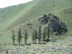
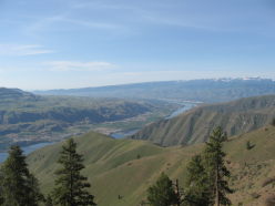
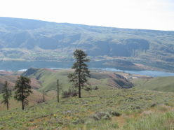
Last weekend, my friend JP from Portland came up and met me after work on Thursday, and we headed east to the dry side of the mountains for a late spring hike. Our destination was a place called Tenas George Canyon. I won't write too much about the details of this hike, because there is already great info available at these two sites:
http://www.justgetout.net/Wenatchee/14805
http://www.nwhikers.net/forums/viewtopic.php?p=597964
But I will add two tidbits of info:
1. There is a bus stop near the base of the canyon, at the intersection of ALT-97 & Tilly Lane [map], serviced by Link Transit Routes 21 and 26. Therefore, you can easily get to this trail without a car, using the Northwestern Trailways bus; there is one morning bus and one evening bus each direction every day. The bus/train station is adjacent to the Columbia Transit Station, where you catch the Link buses. The Link buses run fairly regularly, except on Sunday when they do not run at all. Fare is $1.
2. We found good water at Rattlesnake Spring. As we got into the higher elevation area, we started to run low on water. There was not a drop of water to be found in the dry stream bed in Tenas George Canyon. We did run across several rainwater catchment devices that were full of water [photo], but the water was green and murky and full of deceased insects; we weren't sure if these catchment devices were put here for livestock, wildlife, or emergency water for humans. The USGS 7.5" map shows Rattlesnake spring at about the 4400' elevation level, and we really hoped that we would be able to get good water out of it. We were in luck, there was a small pool of clear and fresh water located just SE of the old road nearest to the spring [photo]. We filtered and drank about 2 liters each right then and there. A flat area close to Rattlesnake Spring provided a nice place to camp, and this is where we camped on Friday night.
On Saturday morning we headed back down a ridgeline just south of Tenas George Canyon, returning back to the bus stop on ALT 97 & Tilly Lane, just in time to catch a Route 21 back into town. We had a small feast at Toco Loco, and then headed back to Seattle.
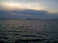
Amie & I are now headed northbound on the Amtrak Coast Starlight, and both of us have spent the time on board updating the blog with our activities of the past week.
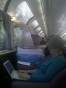
This morning, we were supposed to catch the 7:10 AM inbound Metrolink train at San Bernardino, and we reached the depot about 12 minutes prior to departure, but at the depot we were informed that the Metrolink train would not be serving the station this weekend due to construction; the closest place we could board the train was at Rancho Cucamonga, about 15 miles away. We raced to Rancho Cucamonga, knowing that the Metrolink train probably travels faster than us driving on this arterial with traffic signals. We arrived just as the train was about to depart, and just barely made it on that train. Many other people were rushing to board that train as well; some made it, some didnít. If we hadnít made that train then we would have had to drive all the way to Los Angeles to make our train to Seattle, and Grandpa would have had to drive all the way back. Since we were lucky, we reached Union Station with plenty of time to catch our northbound Coast Starlight. We were soon comfortably settled in our sleeping car and headed northbound towards home.
There was so much to do in and around Palm Springs that we were quite busy the whole time we were there; we could have easily spent 3 weeks there. With so much unfinished business, we will have to make a return trip sometime.
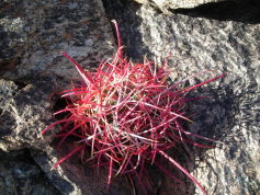
With just one day left to in Palm Springs, and after a late start, we headed in our rental car from Palm Springs into Joshua Tree National Park. To our surprise and delight this week was National Park week, and they waived the $15 entrance fee at the visitor center. We settled on a six mile loop hike without too much elevation gain at a place called Quail Springs. The hike started at a granite rock outcropping in the middle of a vast flat plain that looked like a deliberately planted orchard of Joshua trees. We joked that it was named Lost Horse Valley because if you tied your horse to a Joshua tree you might never find it again. The first two miles were in a drainage wash along the toe of a mid-sized mountain. Upon rounding the mountain we started up a gentle valley on the back side. With every change of elevation, we were indulged with new species of plants and spectacular sights. The dense Joshua tree valley gave way to patches of prickly pear and barrel cactus, yucca plants in full bloom, scrub oak, and the infamous chollo cactus which literally jump to attach themselves to you with their tiny barbed spines. We also saw a zebra lizard, and maybe some kangaroo rats or other desert rodents. From the top of the valley, we descended steeply through a boulder drop drainage into the Lost Horse Valley from where we started. New species of wild flowers peaked out from the moist underside of these immense boulders. The day and the hike was perfect.
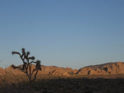
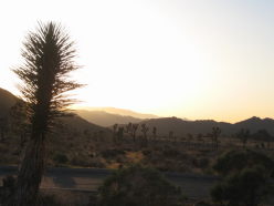
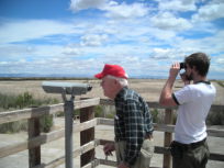
Today, Amie, Grandpa, and I piled into the car and toured the Salton Sea. The Salton Sea is a body of water that was formed about 100 years ago when an irrigation mishap caused the Colorado River to drain, for a period of about 2 years, into this valley below sea level. The ďsea?has been here ever since, gradually increasing in salinity and toxicity over the years.
We circumnavigated the Salton Sea in a clockwise direction, making stops at the Salton Sea National Wildlife Refuge, some geothermal plants at the south end of the Sea, Bombay Beach, and a lunch stop in Calipatria. Our last stop was at the Salton Sea State Park, where unfortunately the visitor center was closed, contrary to the posted hours, but we did watch some brave fisherpersons reeling in some Tilapia. The Tilapia appeared to be quite plentiful. We questioned how safe they would be to eat, although the Pelicans seemed to enjoy them quite a bit.
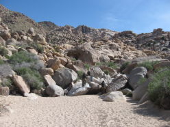
Wednesday afternoon we were lucky enough to hook up with friends local to the Yucca Valley and Joshua Tree area. After touring their beautiful gardens and native desert landscape, complete with many mature Joshua Trees, Century Plants, and Tower of Jewels in their yard, we went for a quick hike in the Indian Cove area. Decomposing granite boulders formed a narrow wash, up into a Dr. Seussian boulder field. Prickly Pear, Desert Lavender, Ocotillo, Datura, and Scrub Oak graced the view and the scents of the canyon. Water trickled through in some areas, but had mainly retreated underground for the long dry season ahead. Some rocks had been polished so smooth by the coarse sand you could slide down. Others were coarse and scratched both skin and textiles with little pressure applied. We played amongst the boulders then rested while Owen attempted to climb a rather large boulder visible from our playground below. It was deceptively difficult and he returned with numerous scratches and a big grin.
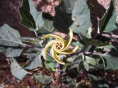
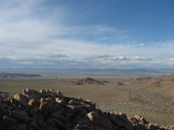
Dinner was had in Palm Springs at Native Foods. This place is awesome! If you are in Palm Springs and interested in eating healthy delicious food, you should definitely check this place out.
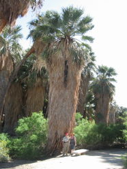
Grandpa picked us up this morning and we proceeded to Palm Springs, but not before going a geology detour! We checked out the San Andreas Fault along I-15 and some other interesting geologic features in that general vicinity.
After lunch with Grandpa and Winnie, we went to the Thousand Palms Oasis, an actual desert oasis with actual wild palm trees, which was formed along a fault line where water seeps to the surface. I had heretofore thought the Palm trees were silly landscaping features, but these wild and unmanicured palms were really cool!
Later that day, we got checked into The Oasis, a timeshare condo that was graciously facilitated by Amieís parents. It was going to be a rough next few days, in a 2 bedroom condo with full kitchen, private patio, and 7 swimming pools to choose from.
I have skipped town for a mini vacation to California. Amie was in the Bay Area presenting at a conference, so I am meeting her there and we are going to hang out for a few days. Then, we head down to Palm Springs to visit my Grandpa, who I haven't visited in like forever. We will be close to Joshua Tree National Park, so we are planning to do some hiking, biking, rock climbing, with geology lectures I am expecting thrown in between.
Yesterday was an exhausting day. Not only did I have to pack for this trip, but I had to pack up my office at work because it is being moved (a whopping 100' or so) while I am gone. I spent most of the day packing things into boxes and labeling them per the detailed procedures, and I was pooped when it was time to head home and start doing more packing. I already dislike the packing part of these trips, and having to pack up the office before this was far from helpful. I managed to pack all my clothes and a bunch of climbing gear into a duffel bag, but it was super heavy and a chore to drag over to the bus stop in the morning.
Now I am on the train cruising southbound through central Oregon. With my Droid I can now update my blog on the fly, although is a bit cumbersome to do so; I have to FTP the file to my Droid's internal memory using ES File Explorer, work on it with a text editor, then FTP it back.
I'll arrive in San Jose around 9:30 tomorrow morning, where I will have to figure out a new transit system and find Amie.
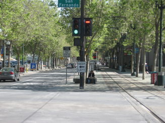
Side Note:While in San Jose, I had several opportunities to ride VTA's light rail system, and I thought it was notable how the line has been built through Downtown San Jose. Downtown San Jose shares many similarities with Downtown Bellevue, here in the Puget Sound area. There is currently a debate about how Sound Transit's new East Link light rail line should be built through Downtown Bellevue, and I think San Jose provides a good example that Bellevue could follow. The photo below is an example of this. The light rail runs at-grade separated from traffic, but through a kind of pedestrian plaza, similar to trams in Europe. Although the trains run slower through this at-grade section than they would through a tunnel or elevated section, I found that it was very quick and easy to walk to the stations and board a train, no stairs, no esclators, no directional disorientation (like I always get at Westlake Station), you could see a train coming from many blocks away, and the stations felt inviting and safe. Plus, the trains visibly running through the plaza seemed to contribute to a lively atmosphere in the downtown area. I think Bellevue has a chance to use their new Sound Transit line to really transform their downtown area into a more lively and walkable area, and should use San Jose as an example, rather than bury it away under a tunnel as the current preferred alternative would do.
This coming weekend I will be playing with Titanium Sporkestra at Honk! Fest West. This is a 3-day street band festival that will invade several different neighborhoods around Seattle, including Fremont, Central District, Georgetown, and West Seattle. The number of bands coming to Seattle and playing at Honk! Fest West year is pretty ridiculous. Apparently permits have been obtained so that streets can be closed to traffic as the party spills out onto them.
Titanium Sprokestra was previously a drum-only band, but has recently materilaized a horn section, currrently including four trumpets and myself on sousaphone. The drums in Titanium Sporkestra are pretty loud, so I will have to be careful to pace myself and not overblow this weekend.
Last weekend I did something new, I went kayaking! Amie & I decided to rent a pair of kayaks from Aqua Verde in the University District on this lovely spring day. The place was kind of busy on a warm Saturday, but we got situated after not too long of a wait. Once in the water, we headed towards the arboretum via the Montlake Cut. The Arboretum is an interesting place to explore, with little lagoons and estuaries to check out amidst the abandoned SR-520/R.H. Thompson Expressway interchange. I recalled from my youth being bitten by a swan while on a family canoe trip in this area. We didn't see any swans this time, but we did see a couple of mean-looking turtles and some overly-friendly ducks.
After circumnavigating Foster Island and taking a beer/snack break, we aimed our rudders westward, back towards the Montlake Cut. The water was pretty choppy in the Cut from all of the boat traffic, and I got some water under my skirt. But this was a minor annoyance and we were soon back in Portage Bay to return the Kayaks.
Kayaking was fun and I would like to do some more of this.
I thought I would share a solution that I discovered a while ago for attaching a Bob Yak trailer to a bike outfitted with an Eno Eccentric Hub. When I identified this problem and began searching for a solution, a google search yielded no information on the subject, and the Bob customer service reps were equally baffled. However, I found a nice solution that I thought I would share on the internet. I will not be addressing such questions as: "Why the heck would you want to attach a trailer to a single-gear bike?
The BOB Bike trailers generally attach to the bike by means of a custom quick-release skewer that is a bit longer than the standard skewer and has a pair of "bobbins" on the end that the trailer latches on to; this works great for bikes that have standard quick-release hubs. Bikes that don't have a quick-release skewer generally have a threaded axle that sticks through the dropouts and attaches to the frame with a pair of nuts on the outside of the frame; for this kind of bike, one can purchase a set of Bob Nutz, which replace the axle nuts and have the bobbins on the end. Neither of these solutions work with the Eccentric hub because it attaches to the frame by way of a allen bolt and collar that screw directly into the hub.
I purchased a set of Bub Nutz (although the only parts that I ended up using from the Bob Nutz were the two bobbins and two washers) and headed down to Tacoma Screw, the premier source for miscellaneous nuts and bolts in the greater Puget Sound area. With the sample parts I brought in, the nice salesperson at the counter helped me figure out a combination of bolts and spacers that would do the trick. Basically, I found a pair of allen bolts that matched the ones used to attach the Eno hub, except they were an inch or so longer so that I could thread it through the bob bobbin. I actually bought pair of two different sized allen bolts, so that I could tweak the width to best match the width of the trailer attachment. I also got some spacers to use to situate the bobbins at the correct width for the tailer. The spacers not only had to hold the bobbins at the correct spacing, but they also had to be able withstand the high level of force needed to tighten the bolt hard enough so that the Eno hub does not rotate while riding. Finally, I put a washer on the ends so that the bolt would fit snug against the bobbin.
I assembled all of this together in the Tacoma Screw Parking lot, to verify suitable attachment of the Eno Hub. This was successful on the first try, and I rode home to try it out with the trailer. I had to adjust the spacers a bit to get the width just right for the trailer attachment; the best combination seemed to be to have one spacer on one side and two on the other. With the correct spacing locked in, I wrenched down the bolts and attached Bob. Success! I rode to the grocery store and loaded up Bob with a half-rack of beer and an economy size package of toilet paper - things I was heretofore unable to tote home via bike.
Here are some close-up photos of my DIY Eno-to Bob attachment:
[Side View] | [Top View]
© 2010 Owen Kehoe
Route feedback to: