Welcome to The 0K Blog
September 09, 2009
Finally, Dry
I have made it safely home from my adventure in the Alpine Lakes Wilderness. I wish I could say that the trip went well, but really the weather was terrible and we were only able to complete about a third of our itinerary. We got soaked with incessant rain, kept awake all night by thunderstorms, disoriented by fog, and even awoke one morning to find an inch of snow on the ground! Despite the uncooperative atmosphere, the trip was still a worthwhile and unique experience; hiking within the clouds and rapidly-changing weather gave the mountains a eerie ambiance and it was interesting to watch the clouds swirl and rainclouds form right before our eyes.
Anyways, that's about as much as I'm going to write about the trip, but I have posted a selection of my photos from the trip in my online picture collection, and you can view them here:
Alpine Lakes 2009 Photo Gallery
August 31, 2009
Departing to the Mountains
Tomorrow I leave on a 9-day hiking/scrambling adventure in the Alpine Lakes Wilderness. My friend Daniel Carleton and I plan to start up the West Fork Foss Rivier Drainage, and end up in the Icicle River canyon. We'll visit remote Alpine Lakes, traverse high ridges, and scramble up several peaks including Mount Hinman and Mount Daniel. If all goes well, I'll be back in town on September 10.
July 18, 2009
LRT is cool
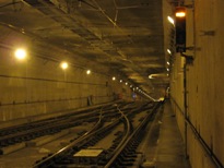
This Monday is the first day of regular weekday operation of Sound Transit's LINK Light Rail Transit (LRT) Line. Although the grand opening was last Saturday, today was the real deal, with fares enforced, actual bus-train operation in the downtown bus tunnel with actual passengers, and for the first time actual commuters on board the trains.
I decided to become one of those commuters this morning. At 8:09am, I left the house on bike, rode to the Mount Baker Station, took the elevator up to the platform, waited no more than 2 minutes for a train, and then cheerfully loaded my bike onto it. The pristine bike hook in the rail car was now soiled with gunk from my front wheel. 7 minutes later, the train arrived at the International District Station in the Downtown Seattle Transit Tunnel, where I unhooked my bike and deboarded. By 8:29, I arrived at the office; about 20 minutes door-to-door travel time.
This wasn't my first ride on the LINK train. Back in October 2008, I rode one of the trains back and forth through the downtown transit tunnel while collecting dwell time and travel time data during the bus-rail joint operation test. Also, I did go on a ride on opening day on Saturday, because I couldn't resist. But this was the first ride with a real transportation purpose.
In the evening after work, Amie & I took the Water Taxi to West Seattle and had a nice dinner at Salty's on Alki, to celebrate our new ability go stay out in West Seattle late without having to ride our bikes over Beacon Hill to get home. After some nice drinks and appetizers, we set off on our bikes, over the lower level West Seattle Bridge, towards the SODO Link station on Lander Street. Minutes later we were at the Columbia City Station and a quick downhill bike ride from home.
Although the nearest Link Station is a little bit of a hike from our house, the fact that we can now just hop on a train and go under Beacon Hill with our bikes, or even ride an elevator to the top, is pretty revolutionary.
July 15, 2009
Living with Chicks and Cocks
I have been neglecting to post an update about the status of our chicken flock.
As you may remember, our dear Walnut Chicken passed away several months ago, and we were on the hunt for a replacement. Well, back in May, we obtained three new chicks. All three are of the Silkie breed, one is white and two are black. As you can tell from the figure below, Silkies are like the poodles of the chicken world; they have fur rather than feathers, ridiculous plumage on the top of their heads, and fur on their feet.
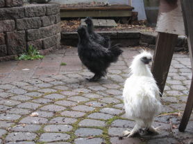
The new members of the household are named Kuan Yin, Mr. T, and Congee, Kuan Yin being the white one. We had early suspicions that Kuan Yin and Congee were roosters, and so we named the latter after the chinese soup because keeping two roosters are not in our fowl ambitions.
By mid-June, Congee and Mr. T started to crow. First it was an irregular occurrence, and sounded like someone stepping on a squeaky squeeze toy. But now the crowing has significantly increased in volume and frequency, and begins on a regular schedule beginning at about 5:00am each day. Kuan Yin is still an unconfirmed gender; s/he has spurs on her/his feet, but still has not started crowing like the others.
Due to our lack of sleep and the fact that the fellows are starting to get aggressive, we are thinking that it is time to thin the flock, and we have tentative plans to have a fresh chicken dinner this weekend.
June 30, 2009
Carbon River, Carbon Free
I’m really digging this bike camping thing; just a couple weeks after my Mountain Loop adventure, I decided to do another bike/scrambling trip, this time to Mt. Rainier. The plan was roughly as follows: Load my bike and trailer onto a Sounder commuter train, take the train to Puyallup, ride up the Carbon River drainage as far as possible on a bike, spend a day hiking/scrambling, then ride all the way home. The beauty of this 3-day plan was that the Sounder train would give me a head start on a ride that would climb 2000' in elevation, while the ride home would begin with a 2000' descent.
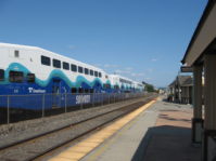 On Friday, my plan was to catch the first afternoon southbound Sounder Train at 3:15pm. I have been hesitant to take my BOB trailer on any buses, since it is bulky and bus drivers have every right to fear me bringing it on board a crowded bus, or even a non-crowded bus. I figured the Sounder Train was a safe bet since they have spacious bike stowage areas. The most difficult part about going on these extended weekend trips, by far, is the required packing. To maximize my ability to travel within the allotted time, I often concoct ambitious plans to pack the night before and leave early in the morning. However, after I get home from work, eat/make dinner, then clean up after dinner, it becomes quite late and I lose the energy to round up all of the stuff that I could possibly need away from home. So this time, I elected to not do any packing at all on Thursday, and instead start packing on Friday morning and take the earliest afternoon train.
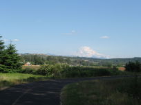 Turns out that this was still not enough time; as 2:40pm rolled around, when I would need to leave to catch the 3:15 train, I still didn’t have everything packed. I think I spent too much time browsing and printing out all of the interesting and relevant maps that I could find on the web. The next train was at 3:50pm, and this was the train that I boarded. The hardest part about getting on the train was getting both bike and trailer into the elevator at King Street Station and down to the platform. Soon I was heading southbound on a packed train full of commuters. About an hour later I alighted the train at Puyallup, re-attached BOB, and set out to find the Foothills Trail. The Foothills Trail follows an old Northern Pacific Railroad grade that once extended from the main line in Puyallup to the town of Carbonado deep in the foothills of Mt. Rainier. The trail is currently developed from just outside Puyallup to the town of South Prairie, although Pierce County has plans to extend the trail all the way to Carbonado in the indeterminate future.
I rode along the nicely-paved Foothills Trail to South Prairie, making good time. Once I reached South Prairie, the trail abruptly ended and I was on my own to navigate the rest of the way up the Carbon River. My maps showed that there was an “A.P. Tubbs. Co. Rd.” connecting South Prairie with Carbonado, providing an alternate route to SR-165, so I thought I would give it a try. Tubbs Rd began by immediately gaining lots of elevation within a short distance, then flattening out. Soon I had to make a right turn to continue on Tubbs Rd, and I found myself riding through a platted, undeveloped subdivision. This seemed suspicious, but according to my maps, it was the way to go. After more elevation gain, the subdivision ended and there was a chain link fence across the through route; beyond the gate was a logging road of mediocre quality. 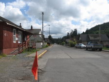 Again I consulted my maps, and again they indicated that I would end up at Carbonado if I continued on this road. With much difficulty I hefted BOB and my bike over the gate and continued on Tubbs Rd. The road quickly became very steep and rough and I began to question whether this was the best choice of route. After about a mile of this, I reached another gate and a refreshing return of pavement beyond the gate. Soon Tubbs Rd brought me to the town of Carbonado. Carbonado is an interesting place; it was an old company town built to support an expansive coal mining operation. Even though the coal mining operations have long since ceased, Carbonado still seemed to support a healthy population. The dense craftsman-style houses, sturdy concrete pavement, and elaborate curb, gutter and sidewalks along the streets seemed out of place in this remote outpost in the Cascade foothills.
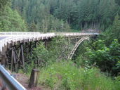 After reaching Carbonado, the highway was the only route continuing up the valley. By this time it was almost 7:00pm, and there was very little traffic on this part of the highway. The highway gradually gained elevation, crossed an impressive old steel-arch truss bridge over the Carbon River, and eventually reached the Mt. Rainier National Park boundary. At the park boundary, the Carbon River road is permanently closed to motorized vehicles, but bikes and feet are allowed to continue. To continue into the Park, one is supposed to deposit a $5 per person fee in an envelope, write one’s license place on the envelope, detach a receipt and place it on one’s dashboard, then deposit the envelope into the provided slot. I, however, felt that my lack of license plate or dashboard exempted me from this fee. I was also supposedly supposed to obtain a backcountry permit to camp at the Ipsut Campground up the old road, but the ranger station closed at 5:00pm, and this seemed impossible, it now being about 8:00 pm.
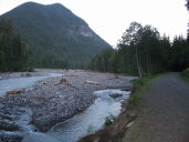
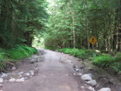 I continued up the Carbon River Road, and could see why it is no longer maintained for vehicular travel, about a quarter of this 5-mile length of road had been reclaimed by the Carbon River, with narrow bypass trails now constructed around these washouts. By about 9:30, I reached the Ipsut Campground at the end of the old road. This was as far as I could take my bike, and I would camp here for the next two nights. The Ipsut campground seemed like it was once a popular car camping area, complete with running water, trash service, and about 30-40 sites furnished complete with picnic tables and grills. Now, it is semi-overgrown and partially washed out, having a somewhat post-apocalyptic aura to it. I selected the second best site in the campground; the one other party here having already taken the #1 site. For dinner, as it was getting dark, I snarfed down a Bahn Mi sandwich that I had picked up in Seattle before boarding the train, and then crawled into my bivy sack and got a good night’s sleep.
On Saturday morning, I woke up and had a leisurely breakfast. I wasn’t sure exactly what I wanted to do with the day, I basically thought that I would head up the Carbon River trail and see what called me. There were several options, such as following the Carbon River up to Moraine Park, scrambling up Sluiskin Mountain, or heading up the Wonderland trail towards Seattle Park. I packed up my day pack and headed up the trail.
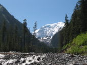 About 2 miles up the trail, it splits, with one branch crossing the Carbon River. The park service had improved this crossing with a series of footlogs over the ever-changing braided river channels. This crossing enabled me to intercept the Northern Loop Trail up to Windy Gap and the vicinity of Sluiskin Mountain, so I decided to head that way. The Northern Loop Trail immediately begins to gain elevation on a multitude of nicely-graded switchbacks, snaking through an impressive old growth forest. At about the 5100’ level I abruptly hit snow and the trail became more difficult to follow. With a bit of routefinding, I made my way to Windy Gap.
 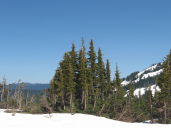 Sluiskin Mountain appeared in the distance, but also appeared that it would be an ambitious scramble. I wasn’t feeling the need to over-exert myself today, so I decided instead to scramble up Tyee Peak, northwest of Windy Gap. Tyee peak was not a difficult scramble: a walk up a broad ridge, and then a short pitch of Class 3 or 4 scrambling up a rocky neck to the peak. There was a summit register encased in a threaded PVC pipe at the top; however, upon opening the pipe I discovered a drenched log book and about a cup of water inside. Rather than risk having the log book disintegrate while unfurling it and attempting to add an entry, I instead just left the pipe cap open and placed it under a rock so that it could eventually dry out. If anyone is planning to summit Tyee Peak in the near future, would you please add the following entry to the log book?:
Owen Kehoe: June 27, 2009
Reached summit using only human power from Puyallup train station. Will now hike back to Ipsut Campground and then ride bike back to Seattle.
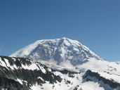
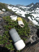
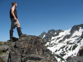
I ate lunch at the top, while enjoying the marvelous view of Mt. Rainier from this vantage point. Then I began my descent. Part of the reason that I chose to scramble up Tyee Peak was that I had identified a slope with awesome glissading potential for the descent, and my theory proved correct. I was soon back on the trail switchbacking my way back down to the Carbon River, and back to camp. 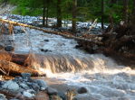 The sun was nearing the horizon when I reached the Carbon River crossing, and so I decided to take a bath and cleanse my stinky self here while the sun was still shining, the ambient air temperature being an important consideration before immersing oneself in a glacial fed river. I was back at camp with just enough daylight available to make dinner and crawl back into my bivy sack.
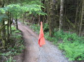
On Sunday morning, I packed up BOB and headed back down the Carbon River road. Within no time I was back in Carbonado, where I decided to follow the main highway rather than deal with the dreaded Tubbs Road. I soon intercepted the Foothills Trail again in South Prairie. Apparently there was some kind of organized bike ride going on, the Tour de Pierce, and I found myself riding against a swarm of other bicyclists as soon as I reached South Prairie. Several people asked me for directions on the route, but I really didn’t have any clue where they were supposed to go; I was just trying to ride back to Seattle.
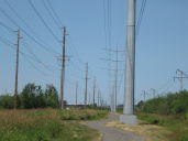 With a brief snack break in Orting, I was soon back in Puyallup. There would be no Sounder train to take me back north on Sunday, so I now had to ride the remaining 30 or so miles back home. I stopped for some lunch at a diner in Sumner, and confirmed that eating a heavy meal before a long bike ride is not the best idea. Several miles north of Sumner is the southern terminus of the Interurban Trail. The Interurban trail provides a straight shot through the industrial Green River valley to Tukwila. After a long slog fighting against a significant headwind, I arrived in Tukwila and navigated my way through Renton to familiar territory on Rainier Ave. By late afternoon, I was back home.
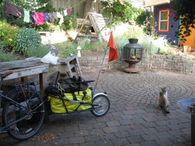
June 5, 2009
Mt LooP
Over the Memorial Day Weekend, I went on a grand adventure around the Mountain Loop Highway. I started from my house and rode my bike in a 200+ mile "P" shaped loop, scrambled up a 6200' peak, and attempted to visit a remote mine site, all in 4 days and transporting myself only using energy from my own metabolism.
Day 1, Friday
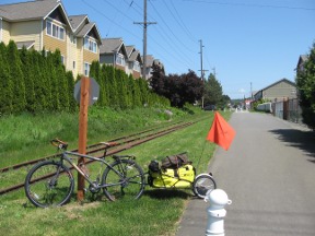 My goal for today was to ride as far up the Mountain Loop Highway as I could and then camp wherever that might be. I woke up bright and early and finished packing. My New BOB bike trailer is what really made this trip possible; I fit my camping gear in BOB's sac, strapped a day pack on on top of the sac, and by 9am I attached BOB to my bike and left the house. The first leg of my trip took me up Lake Washington Blvd and up the Burke-Gilman, familiar territory. At Woodinville, I pulled out a map I found on bikely.org and made my way towards Snohomish. I went up some very steep hills: it seems like there is no good route between Woodinville and Snohomish that avoids steep and rolling hills. In Snohomish, I picked up the Centennial Trail, which follows the original right-of-way of the Seattle Lakeshore & Eastern Railway. This is the same rail line upon which the Burke-Gilman Trail is built. There could potentially be a continuous rail-trail from Ballard all the way to Arlington, except that BNSF is still using the tracks between Woodinville & Snohomish. I followed the Centennial Trail northward until it intersected SR-92, then I followed SR-92 into the town of Granite Falls. This section of SR-92 is not too bad to ride on; nice wide shoulders the whole way and a scenic bypass available on "Crooked Mile Road." In Granite Falls I stopped at the Liquor store for some important supplies and had a delicious Veggie Sub at Omega Pizza & Pasta.
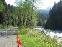
After lunch, it was time to venture onto the Mountain Loop Highway. Elevation gain began soon after leaving Granite Falls, including one daunting hill with about 600' of gain within a perfectly straight section about one mile long. The Mountain Loop Highway has a nice shoulder on the south (uphill) side, so riding the loop in the counter-clockwise direction is ideal. I continued through the townsites of Robe, Verlot, and Silverton, stopping for breaks and interesting scenery along the way.
As 6:00pm rolled around, I made it to the Big Four Picnic area and Ice Caves Trailhead. This was a beautiful area, but it was clear from the abundant signage that camping was verboten. However, the parking area was also closed off with a large gate, while my handlebars just barely fit under the gate. At the picnic area, some contractors who were working on replacing the bridge on the Ice Caves trail were just finishing for the day and had set up an ad hoc camp in the parking lot. I asked if it would be okay for me and my bike to camp at one of the picnic spots for the night; they didn't exactly say it was okay, but they said that the ranger certainly wouldn't be coming by until 9AM the next morning. With that info, I set up camp at what must be one of the most beautiful sites along the Mt. Loop: an expansive grassy field right at the base of Big Four Mountain, with a full compliment of picnic tables, a shelter, vault toilets, and not a single RV, generator, bratty kid, or campfire smoke anywhere for miles around. This place was also teeming with birds, as I cooked dinner I saw a goldfinch, a woodpecker, hummingbird and a pair of Stellar's Jays that acted like they were going to make off with my dinner the instant I might turn my back. I set up my bivy sack in the grassy field and drifted off to sleep as the stars and Milky Way shone brilliantly overhead.
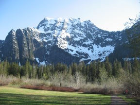
Day 2, Saturday.
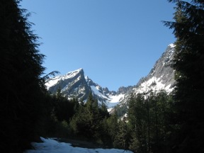 Today's mission was to scramble to the top of Vesper Peak. I woke up, ate breakfast, and was packed up by 8:00, well before the ranger might come by to evict me. The Route to Vesper Peak starts at the Sunrise Mine Trail, just a couple of miles up the highway from where I camped. Two cars were parked at the turnoff when I arrived. The Sunrise Mine Road had too much snow to be drivable, but I was able to ride about 1/2 mile on the road before the snow became too deep. There I stashed my bike and put on my hiking boots. I followed the road for a couple miles to the trailhead then picked up the trail, which was actually free of snow for some distance under the forest canopy. Crossing the creek that drains from Del Campo Peak was a bit challenging; the best way to cross it seemed to be to go upstream for a ways and hop across on some woody avalanche debris. After the creek crossing, the trail became steep and started to get buried under snow. As I approached Headlee Pass, the terrain became very steep and the snow was becoming pretty soft in the warm weather. Luckily, there was a set of well-gaited footprints in the snow that I could follow, which made the going much easier.
At Headlee Pass, the summit of Vesper Peak became visible, and the remainder of the route fairly obvious. Just past Headlee pass I met the source of the footprints, a fellow with an overnight pack who was intending to hike to Copper Lake and camp there. The climb up Headlee Pass was so taxing that he called it quits at a depression just at the base of Vesper Peak and set up his camp there. I thanked him for the footsteps and continued the final push to the summit, now with an unbroken path on soft snow. It was slow going, with each step I had to pause to let the snow consolidate to that I could push onto the next step. As I almost reached the top, I was passed by a skier who was making good time on his skinned telemark skis. 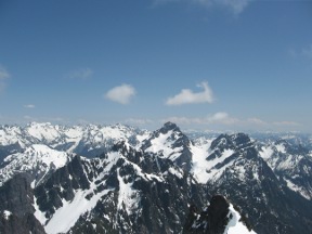 He was surprised to see me since the number of vehicles at the trailhead vs. the number of parties he had encountered did not correlate. We both reached the summit at about 2:30 in the afternoon, and absorbed the marvelous view. Vesper Peak is at about the same elevation as Big Four Mountain, ~6200', and just SE of the more-famous peak. I had views of Mt. Baker, Glacier Peak, Mt. Rainier in the haze, and Spada Lake in the distant valley below. It was an exhilarating thought that I had made it all the way to this spot from my home in South Seattle all on my own power.
After eating some lunch, I watched the skier make a run down the mountain and reach the traverse over to Headlee Pass in about 5 minutes (It had taken me over an hour to climb up that distance). Soon after, I started my plunge-step downward. I was hoping to glissade most of the way, but by now the afternoon heat had turned the snow to a consistency of runny oatmeal, and glissading was not possible. Nonetheless it was a quick descent, and I was back to my bike around 4:30 in the afternoon. Since my campsite from the night before was so wonderful, I decided to backtrack a few miles on the pavement and try camping at the Big Four No-Camping Area again. The contractors were still there and it was the same drill. They were very nice and even gave me some water.
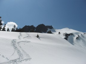
Day 3, Sunday.
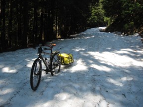 I didn't have much on my to-do list today. From the reports I had gathered from the Snohomish County DOT website and the ranger station, I knew that the Mountain loop Highway was not plowed past Barlow Pass, and I was not certain that I would be able to complete the loop on my bike due to the snow or if I would have to retrace my path from there. So before I could really make any other plans, I had to go check out Barlow Pass and test out the snow. Also, I wanted to do the snow push first thing in the morning while the snow was still firm, so this became item #2 the agenda (Item #1 being breakfast).
It didn't take me too long to ride to Barlow Pass, elevation ~2400' and just a few miles uphill from Big Four. Sure enough, the plow had only made it this far and the road towards Darrington was under several feet of snow. I contemplated for a few moments about what might be the best way to attempt to transport my bike, trailer, and myself through this section. The best way seemed to be to put on my hiking boots, leave the trailer attached and push the bike. This turned out to work pretty well, the snow was still fairly firm and when I did encounter soft spots, the trailer would just scoot along like a sled.
After about 1/2 mile of pushing, the road was clear again and there were tire tracks from vehicles that had approached from the Darrington side of the loop. Since the push through the snow did not take very long, I had the rest of the day ahead of me with no specific plan for what to do with it. I found an unofficial campground along a nice section of Sauk Creek and opened up my Discovering Washington's Historic Mines book that I had brought with me. After some perusal, I discovered that the Bornite Mine near Darrington looked interesting and was somewhat on the way. My new plan was to ride to the Bornite Mine camp, set up camp there, and then explore the mine. The location of the Bornite Mine would also allow me to complete a good portion of the Mt. Loop today, giving me a good start for the ride home on Monday.
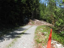 After brushing the snow off of my pedals and disc brakes, I continued descending along the gravel portion of the Mt. Loop highway, heading north. This descent was a blast, further confirming that counter-clockwise is the best direction to attack the Mountain Loop on a bike. The road was dusty, but thankfully the vehicle traffic was pretty light due to the lack of a through route. In quick time I was at the White Chuck Campground and back on a paved road. But not for long because I then turned off onto USFS road 2060, the route to the Bornite Mine. This road gained about 800' of elevation fast. After about 2 miles I came to an obstruction of deep avalanche debris. Cars would go no further on this road, but I was able to unhitch my trailer and shuttle my gear around the obstruction.
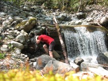 I continued along the mine road, and the condition of the road became progressively worse. I unhitched the trailer four times to go around downed trees until I got fed up with this activity and abandoned plans to camp at the mining camp site. With BOB and my bike stashed in the woods and my day pack strapped to my back, I continued up the mine road. Before reaching the mine camp, the obvious bulldozed road came to an abrupt end. After about 20 minutes of searching and nearly giving up, I located a well-worn foot path taking off just below the road. Within minutes I passed what appeared to be an old pelton wheel foundation and a cable anchorage for the mine's aerial tramway; this was the site of the old mine camp. Although this would have been a fine place to camp for the night, all my camping gear was back where I had stashed my bike. There was a waterfall on the opposite side of the valley from the camp. According to the DWHM book, reaching the mine required scrambling up next to the waterfall and then locating the mine dump further up the valley.
It was getting close to 7pm, and the thought of continuing seemed daunting at this point. I followed the path for a bit longer until I came upon the point where I would have to cross Copper Creek, which was swollen with fresh spring snowmelt. Although I'm sure that I could have managed to ford the creek if I had more time, it seemed somewhat futile this late in the day, so I turned back. Reunited with my bike, I rode back down the road a little ways to a rather attractive campsite between two streams, with a nice view enhanced by someone thoughtfully chopping down some nearby trees. Although I didn't quite make it to the mine, I enjoyed the scenic valley that I had all to myself.
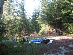
Day 4, Monday
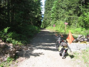 The campsite was situated in a narrow valley, so the sun didn't wake me up quite as early as the past two mornings. I woke up feeling quite refreshed, ate some breakfast, and packed up BOB. The goal of today was to ride home, and it started off with a screaming descent down the old mine road. To improve the stability of my rig, I put my day pack on my back rather than on BOB while tearing downhill. The descent was fun, interrupted only by the larger fallen logs that required unhitching my trailer. I was soon on the paved Mountain Loop Highway and shortly thereafter was in the town of Darrington.
In Darrington, I wanted to stop by the ranger station to see if there was a prize for being the first person of the season to circumnavigate the Mountain Loop Highway; I was sure that I was the one, based on the lack of tracks in the snow just over Barlow Pass. I also wanted to get the latest information on the Whitehorse Trail, a new rail-trail on the old Darrington line. Alas, the ranger station was closed, so I had to ask some locals and use my GPS to find the whereabouts of the beginning of the trail. I found the Whitehorse Trail just a few blocks from the ranger station, where I hopped on and headed north and then westward. The Whitehorse trail goes through some very nice scenery and is nicely shaded, but the surface is currently like freshly bulldozed railroad ballast, not the best surface for riding with a heavy trailer. I followed the Whitehorse Trail for about 5 miles to Swede Haven Road. This was the point where the official website says is the extent of the constructed trail, although it looked like the trail continued in similar fashion past this point. Since I had a long ways to go home today and I needed to make more forward progress, I headed back to SR-530 for the pavement. In the future, when the surface of the Whitehorse trail becomes more compacted, it might provide a better biking surface than it does today.
SR-530 was not the most pleasant leg of my ride. The shoulders are intermittent, there was a steady stream of RV's heading home after the long weekend, and I was riding against a headwind. After what seemed like a long time, I finally made it to Arlington. One nice thing about touring by bicycle is that you seem to get drawn into the older 'Main Street' parts of towns along the way, rather than following the high-throughput bypass routes that you would normally follow in a car. I found myself in old downtown Arlington, which I never knew existed, with lots of nice shops & cafés where I considered stopping for lunch, but I decided to press on towards Snohomish. With a little bit of searching, I picked up the Centennial Trail at its northern trailhead just south of Arlington. I cruised at fast pace down the Centennial trail, dodging erratic kids on bikes and making a stop at a lemonade stand that appeared to be in violation of child labor laws. That's another great thing about touring on bike, it is easy to make all of those interesting stops along the way, like scenic vistas, historical markers, fruit stands, and lemonade stands that you would normally pass by in a car.
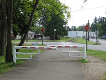
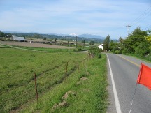 The Mt. Loop was complete when I crossed under SR-92 on the Centennial Trail and I was now retracing my path. I cruised into Snohomish around 4:00pm, hungry for lunch, but didn't want anything too heavy because I still had a ways to go. I found a Thai restaurant and had a nice veggie stir-fry. After Snohomish, the steepest part of today's journey home presented itself rising up to the rolling plateau between Snohomish and Woodinville; I took it fairly easy while digesting my lunch. On the downhill side, I flew through Woodinville and intercepted the Sammamish/Burke-Gilman trail. Now it was smooth sailing back towards home, despite sore thighs and calves. Upon reaching the U-district, I arranged a rendezvous with Amie at the Columbia City Ale House, then made the final push homeward on Lake Washington Blvd. I enjoyed a burger and several beers with Amie as dusk fell.
Total Mileage: 218 miles.
To continue into the past of the 0K Blog, click here: [2009.1].
© 2009 Owen Kehoe
Route feedback to:

< -- BACK TO OWEN'S PORTAL
 On Friday, my plan was to catch the first afternoon southbound Sounder Train at 3:15pm. I have been hesitant to take my BOB trailer on any buses, since it is bulky and bus drivers have every right to fear me bringing it on board a crowded bus, or even a non-crowded bus. I figured the Sounder Train was a safe bet since they have spacious bike stowage areas. The most difficult part about going on these extended weekend trips, by far, is the required packing. To maximize my ability to travel within the allotted time, I often concoct ambitious plans to pack the night before and leave early in the morning. However, after I get home from work, eat/make dinner, then clean up after dinner, it becomes quite late and I lose the energy to round up all of the stuff that I could possibly need away from home. So this time, I elected to not do any packing at all on Thursday, and instead start packing on Friday morning and take the earliest afternoon train.


