Welcome to The 0K Blog
August 25, 2007
Northward Ho
It is about a 24-hour ride on Amtrak from Oakland to Seattle, so I spent today relaxing and watching the scenery go by. The last time that I rode on this rail line was when I went to Burning Man several years ago, but I had a better view that time. Now I have commandeered Amie's laptop so I can catch up on my blog (I actually post-dated and wrote last three days' entries today while on the train.) Here is a new phenomenon on these Amtrak trains; every available electrical outlet has been hoarded by people charging their cell phones, laptops, or DVD players. There seems to be a "charging party" going on downstairs in the women's dressing room on this car. So now my, I mean Amie's, laptop is just about of juice and I don't particularly want to sit in the bathroom for the next 30 minutes, so that's all for now.
August 24, 2007
Farewell to San Francisco
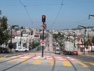 Today was my final day in San Francisco, and I spent it catching up on some work and riding some more transit lines. This time I checked out Muni's new T-Line. I was impressed with the way that the light rail line has been integrated into the center of the street, but I was less than impressed with the signal priority, or lack thereof. It seemed like we hit over half of the lights on red, and had to wait for the full cycle to complete each time. I also took some pictures and video footage of the Muni streetcar's unique operation of unloading passengers right into a traffic lane.
Then I headed back to Oakland .My Amtrak train was scheduled to depart at 9:47 PM, but of course was about 45 minutes late. My friend walked me down to the train station at Jack London Square, and had a few beers at the extremely-rustic "First and Last Chance" bar while we waited for my train to arrive.
August 23, 2007
Biking the Bay Area
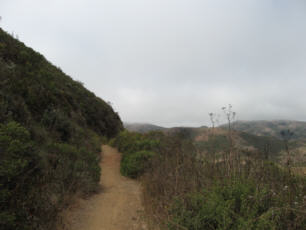 Thursday was my first free day in the Bay Area, so I decided to take the opportunity to check out the non-motorized transportation facilities that San Francisco had to offer. Earlier in the week I had found myself wandering around the Haight-Ashbury neighborhood, and I had spotted a neat bike shop right next to Golden Gate Park, so I decided to head straight there in the morning. I am staying with a friend in Oakland now, since my three days of paid hotel rooms are exhausted. I used BART and Muni rail for actual transportation purposes, the station agents now being a little more suspicious of whether my APTA badge still qualifies for a free ride. For Example:
Me: "Good morning. I'm with APTA conference, I think we get free rides with this badge."
TA: "Oh, one of you...I thought that was over by now."
Me: "Well, I'm still doing some field research through the end of the week."
TA: "Hmmm..."
Me: "By the way, I'm very impressed with your fine transit system here."
TA: "Allright, go ahead, enjoy your stay in San Francisco."
Me: "Thank you, have a nice day"
Anyway, I got myself to Haight-Ashbury in quick time and got outfitted with a so-so mountain bike. I set off to explore Golden Gate Park, an excessively irrigated oasis in the heart of the city. I soon found myself at the Pacific Ocean, and I tried to work my way around the coast to the Golden Gate Bridge (GGB). Well, that wasn't so easy, the bicycle wayfinding infrastructure was not very helpful, and I ended up having to needlessly go up some very steep hills. Eventually I worked my way through The Presidio and to the GGB. The GGB was mobbed with tourists and only one walkway was open for some reason, plus it was incredibly windy; I sure wouldn't want to do this commute every day. When I reached the other side, I headed into the Marin Headlands, and then found a very nice system of trails to explore. I more or less followed the Bay Area Ridge Trail, which climbs way up onto the crest of the ridge {which?}. It was foggy and extremely windy up there, not the most pleasant of conditions. There were very few people up here, surprising considering that it's just a few miles from the hordes at the GGB.
When I reached Route 1 near Mt. Tamalpais, I decided it was time to start heading back. I screamed down this windy paved road and was at the bottom at no time. A few miles of riding on a rail-trail brought me to Sausalito, where I found an Indian restaurant with a vast vegetarian menu, and had a yummy dinner. From here, I had the option of taking a ferry back to SF, and it probably would have even been free with my badge (normally $7.50!) but I decided that I still had enough energy to ride back over the GGB and back to the bike shop, so that's what I did. The GGB was still somewhat mobbed. I noticed that some bikes were using the other walkway, but I didn't see an obvious way to get over there from on the north side of the bridge. This time I had better luck with the bicycle wayfinding signs and I rode directly to Golden Gate Park and returned my bike. I hung out in Haight-Ashbury for a little while longer, and then returned to my crash pad in Oakland.
August 22, 2007
Exploring Transit in San Francisco
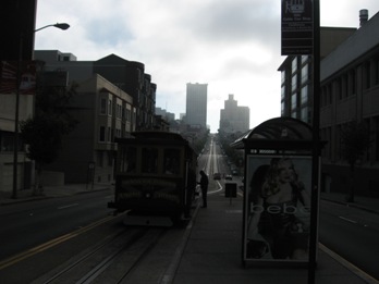 I have been spending the past several days in the SF Bay Area, attending a conference for the American Public Transit Association (APTA). This has been a really interesting trip. My conference badge grants me free travel on almost all of the area's transit systems, Muni including cablecars, BART, AC transit, Golden Gate Transit including ferries; I just show my badge and they wave me through. Except there was one transit operator from a certain transit agency who obviously didn't get the memo, and had the nerve to make me pay the $1.75 fare. The transit systems here are mind-boggling--I am especailly impressed with the Muni Subway/streetcar system. The Breda-made cars are relatively quiet and smooth. The cars run in a high-speed subway through the downtown core, with a train coming every one or two minutes in some locations. Then they exit the subway and become a streetcar running right down the middle of the street. The cars have retractable steps so that they can be used for both platform and street-level boarding. At some of the street-level stops, the streetcar loads/unloads passengers directly into the traffic lane, without even a curb or island in the street; we would never be able to build someting like that today.
The conference began with a day-long tour of the Bay Area's various transit modes; this basically consisted of about 45 transit geeks cramming themselves onto as many buses, trains, LRV's, and ferries as we could fit into a day. Most, myself included, had cameras and used them liberally. Following the tour was three days of panel presentations, where I have been learing about what things other transit agencies are doing across North America including Bermuda. In the evenings between conference sessions, some of us go out and ride more buses and trains where we get a different perspective of things. For example, we asked one transit operator what she thought of the new "TransLink" smart card system, which we learned about earlier in the conference; she simply said "Oh, that thing's trash." She also pooh-poohed the brand new 4-door Vanhool coaches that their transit management has been showcasing.
My contribution to the conference was that I gave a talk on "Bus Stop and Bus Lane Capacity," discussing a method for calculating how many buses/hr can reliably use a bus stop and bus lane, and how we applied these methods to plan bus routings in Downtown Seattle when the bus tunnel opens in late September. I think my presentation was well-received because I got numerous requests for copies of my powerpoint and worksheet that I developed. You can download and watch the powerpoint here, If you want.
So now the conference is over and I have a couple of free days before I have to board an Amtrak train to take me back up to Seattle. Now I think I'll go check out Muni's new T-line. I'll post some pictures after I return to Seattle.
August 9, 2007
One-Way Trip Thru the Alpine Lakes
A couple of weekends ago I went on a 3-day hike into the Alpine Lakes Wilderness. An interesting thing about this hike is that I started on the Highway 2 side of the wilderness, and ended on the I-90 side; something that is not really practical unless one uses public transit and hitchhiking to travel to and from the trailheads.
On Thursday evening after work, I caught the 5:13 PM Sounder Train to Everett, where I caught a Community Transit Route 270 bus, which took me to Gold Bar. In Gold Bar, I easily caught a ride within about 15 minutes. The fellow who picked me up was from North Carolina and was headed to Lake Wenatchee to visit his friend. He was kind enough to go a few miles out of his way to deposit me at the West Fork Foss River trailhead, which put me in an excellent position to get an early start the next day. 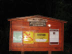 It was just getting dark as I laced up my hiking boots at the trailhead; my plan was to hike about 1.5 miles to Trout Lake and camp there this night. Some trail reports that I read warned of damage on this trail from flooding last year, and ominous signs at the trailhead repeated the warning. Well, it wasn't that bad; I had no trouble negotiating the rocky surface even in the dark with my headlamp. The footlog across the Foss River is washed out, but one can easily hop rocks and other logs to make the crossing without getting one's feet wet. I reached Trout Lake in pitch blackness and camped at that campsite with the big overhanging rock.
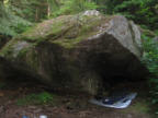
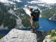 On Friday, I woke up and make a quick breakfast, packed up and continued heading up the trail. After Trout Lake, the trail immediately begins to gain elevation. My pack was actually pretty light; I chose to bring only my bivy sack and not my tent since the weather report was so favorable, so I made quick time up the trail: Passed Copper Lake, Little Heart Lake, and I was at Big Heart Lake by noon. After Big Heart Lake, the official trail ends, but a path continues over "Heartbreak Ridge" southward to the upper lakes. Soon I was on a ridge that overlooks Lake Chetwood. I had been thinking of camping at this lake, but I was making such good progress that I decided to press on to Gold Lake; this would also let me take a shortcut and not have to drop down to the lake and then back up in the morning. To get to Gold Lake, I had to go around the north end of Lake Chetwood, through some steep brushy terrain. This thrash through the brush soon leads to a saddle at the west end of Lake Chetwood. From here I had to drop down about 800' into the next valley to get around a cliffy shoulder, and then back up along talus fields to the next ridge over.
 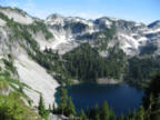 At the crest of this ridge I could see Gold Lake below; it looked so close. I descended towards the lake, but I soon found myself above some cliffs. After about 30 minutes of scouting around, I finally found a chute that I could descend. My feet really hurt by now, and the campsite at Gold Lake that seemed so close was taking a great effort to reach. Finally I reached the well-furnished campsite, but apparently a horde of mosquitoes beat me to it; the mosquitoes here were among the worst that I have ever experienced. Through the thick swarm I managed to cook some dinner and then crawl into my bivy sack, which was thankfully equipped with mosquito netting. That was a long day.
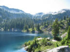
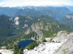 Since I made so much progress on Friday, Saturday could be an easy day; all I had to do was climb up and over Big Snow Mountain to Snowflake Lake. So, I slept in a bit late on Saturday. By the time I ate breakfast and packed up, it was almost noon. I started right up climbing Big Snow Mountain. The only way to get from Gold Lake to Snowflake or Big Snow Lake is to go almost all the way to the top of Big Snow Mountain. Within a couple of hours I was near the top. I saw some recent boot prints in the snow that seemed to be from people coming from Myrtle and Snowflake Lake, the most popular route to the summit, so I dropped my pack and scrambled the remaining few hundred feet to the top. Big Snow Mountain is a high peak, and the view from the top is stunning. I ate lunch and then went back down to rendezvous with my pack. I have scrambled up this route before that I was now descending, but it's still a tricky routefinding exercise.
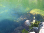
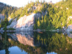 Within another hour or so, I was at Snowflake Lake, where I scoped out a very nice campsite perched on a large Granite formation. The bugs were only slightly less bad here than at Gold Lake. This campsite featured a wonderful swimming platform, and I took a refreshing dip in the lake. The lake wasn't too cold, but it had an interesting stratifying phenomenon going on where if I kicked my feet, it would stir up the cold water at the bottom of the lake. I made a yummy dinner and set up my bivy. As nighttime fell, clouds began quickly forming at the tops of the peaks.
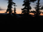
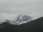 On Sunday morning, I woke up fairly early and quickly made breakfast and packed up. It was cloudy and foggy, but I was just thankful that it didn't rain last night. After a short jaunt over toward Big Snow Lake, I had to descend a steep gully toward Myrtle Lake. Again, my prior knowledge of this route came in handy and I was at Mytrle Lake in short time. At Myrtle Lake, a well-maintained trail connects to the Dingford Creek trailhead on the Middle Fork Snoqualmie River. This trail was a dream compared to the terrain that I had been going through for the past couple of days. It started to sprinkle once I reached Myrtle Lake, but the forest canopy was pretty thick and the trail was well cleared of brush, so I didn't get too wet while hiking the trail. I quickly chomped through the 4.5 miles and -2300' of elevation, and was at the Dingford trailhead by about 1:00 PM.
 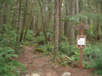 My loop was almost complete; now all I had to do was to find a ride back to Seattle. The Forest Service recently closed off the Middle Fork Road to general traffic right at the Dingford Trailhead, so there were lots of cars parked here. As soon as I walked into the parking lot, I spotted a car that was just about to leave. I asked if they had any room for my pack and I, and I was soon enroute to Seattle. I was riding with two girls who had spent the weekend at Goldmeyer Hot Springs. They actually were headed to Capitol Hill, so they made a short detour and dropped me off right at my doorstep. My weekend loop was complete, and I had ample time to spare before I had to return to work on Monday morning.
July 13, 2007
Buses/Hour
I just added a piece to my portfolio page: a bus stop capacity calculator worksheet with a brief explanation of what it does. Now you too can calculate the number of buses per hour that can stop at your favorite bus stop, assuming that you know the inputs like dwell time and such. I was recently selected to present this topic at the American Public Transit Association's Intermodal Operations Planning Workshop in San Francisco. So in August, I'll be flying down there to talk about bus stop capacity in downtown areas. It's a 3-day conference plus an all-day tour on the Bay Area's various transit systems; what could be more fun?
July 12, 2007
Around the Coast in 5 Days
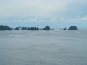 Over the 4th of July "weekend", Amie and I took a little road/hiking trip out to the coast. On Saturday, we left Seattle and headed in a northwesterly direction. We camped that night at Lyre River campground near the town of Joyce, a very nice little campground run by the DNR. We slept under the stars because the weather looked so nice and we were too lazy to put up the tent. The Lyre River is called that because the river supposedly sings like a beautiful song, per the sign at the campground, but all we could hear as we drifted off to sleep was bad music being played out of a boom box from the adjacent campsite.
The next morning we continued driving northwest towards Neah Bay. You can actually take transit buses all the way to Neah Bay, although I haven't looked at the schedules closely enough to see how long that would take from Seattle. We diligently purchased a Recreation Pass from the Makah Tribe for our planned hike to Shi Shi Beach. We also parked in one of the "Enclosed Parking" lots on private property near the trailhead, for $5 per day. We got about a mile down the trail, still on Makah land, when we were stopped by a pair of fully-armed National Park Rangers. We didn't have a backcountry permit (We were planning to fill one out at the kiosk further down the trail, like I have done in years past) and we didn't have a NPS-approved bear-proof food container, which was unacceptable to these rangers. After being called liars for even suggesting that we might decide to just do a day hike, or that we could fit our food for the next day into our three nalgene bottles, and having our license plate number taken down under threat that they would come back and see if we had camped without calling in and getting a permit, we were forced to turn around and go back into town. The rangers said that we could get a bear barrel at Washburn's General Store in Neah Bay. Well, the closest thing that they had was an empty plastic Bazooka Bubble Gum container. With our makeshift bear container in hand, we returned to the trail and made it to Shi Shi just about at low tide. We explored the tidepools for a while and then headed south along the beach and found a very nicely furnished campsite perched above the beach, complete with a rain tarp over the cooking area and a stainless steel pot.
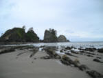 Monday, we explored the Point of the Arches, then packed up and headed back to the trailhead. From there we drove south on US-101, through Hoquiam and Aberdeen, and then into Westport. We "camped" at the Twin Harbors State Park, where people come to get away from it all by packing themselves into a higher person/ft2 density than the average U.S. subdivision.
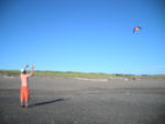 On Tuesday, we went surfing! We rented a pair of boards and wetsuits at a local shop and tried out the waves. This was practically my first time surfing, and it was not easy. It was hard to even get out to where the big waves were crashing because the surf kept pushing us back to shore. Nonetheless, we each got in a few decent rides. I think I broke my toe when I got pushed by a wave and jammed it in the sand, so I had to turn in early. That night we camped out again in the State Park, which was jam-packed and a zoo with drunken people, kids cruising the place on bikes, boombastic music and "Indian fireworks" being set off.
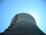 On Wednesday, the 4th, we proceeded east towards Olympia. What would be a trip between Aberdeen and Oly without stopping at the defunct WPPSS Plant in Satsop? Unfortunately the business park that has recently taken over the site has fenced off the partially-built cooling tower, making it just a little more difficult to go inside and experience its amazing acoustical properties. In Olympia, our ex-INB friends David and Alex were having a good old 'merican BBQ, and we grilled some crab and salmon that we imported from Westport. That evening, we headed back to Seattle, thus completing a nice loop.
On Thursday, it was back to work for the both of us.
June 24, 2007
Carbon with your Latte?
Here is an interesting website:
http://climatecounts.org/
This outfit has tabulated "climate scorecards" for various businesses so that you can asess and compare their carbon footprint and relative impact on climate change. For example, you can quickly tell that Apple Computer has one of the worst impacters, while Canon and other electronics companies are doing much more to migitate their carbon footprints. You can use this site to help guide your consumer spending toward companies that are actively doing good things.
Unfortunately, the list of companies is pretty small so far, and limited to major companies, but hopefully this list will grow in time and as more people use it. This website recieves the OK seal of approval, visit it today!
To continue into the past of the 0K Blog, click here: [2007.1].
© 2007 Owen Kehoe
Route feedback to:

< -- BACK TO OWEN'S PORTAL
 Thursday was my first free day in the Bay Area, so I decided to take the opportunity to check out the non-motorized transportation facilities that San Francisco had to offer. Earlier in the week I had found myself wandering around the Haight-Ashbury neighborhood, and I had spotted a neat bike shop right next to Golden Gate Park, so I decided to head straight there in the morning. I am staying with a friend in Oakland now, since my three days of paid hotel rooms are exhausted. I used BART and Muni rail for actual transportation purposes, the station agents now being a little more suspicious of whether my APTA badge still qualifies for a free ride. For Example:
 Today was my final day in San Francisco, and I spent it catching up on some work and riding some more transit lines. This time I checked out Muni's new T-Line. I was impressed with the way that the light rail line has been integrated into the center of the street, but I was less than impressed with the signal priority, or lack thereof. It seemed like we hit over half of the lights on red, and had to wait for the full cycle to complete each time. I also took some pictures and video footage of the Muni streetcar's unique operation of unloading passengers right into a traffic lane.


